
Voici une série de 34 photos en noir et blanc prises à Meyrin à Genève. Ces clichés, réalisés en 1990 lors d’un stage photo, capturent des moments uniques et des lieux emblématiques de ma cité d’enfance. À travers ces images, j’ai voulu capturer une époque (sans le savoir) où la vie semblait plus détendue, avec moins de voitures et plus d’espaces ouverts. Accompagnez-moi dans ce voyage nostalgique à travers les rues et les paysages de Meyrin.
La galerie de photos de Meyrin en 1990
Un Stage Photo au CERN
En 1990, à mes 18 ans, j’ai eu l’opportunité de développer mes compétences en photographie argentique lors d’un stage photo au CERN pedant 3 mois. Avec une carte blanche pour explorer et capturer des images, j’ai décidé de me concentrer sur Meyrin, le lieu où j’ai grandi. Armé de mon appareil photo, j’ai parcouru les rues familières, immortalisant des endroits typiques de la cité.
Les fameux Pavillons de l’École de Meyrin-Village
Ces structures distinctives, construits à l’époque des années fin 60 début 70 étaient des bâtiments provisoires avec leur architecture iconiques, sont un souvenir inoubliables pour celles et ceux qui y ont passé étant enfant. Chaque bâtiment habitait deux classes d’école avec au centre le lieu commun pour les toilettes et les vestiaires.
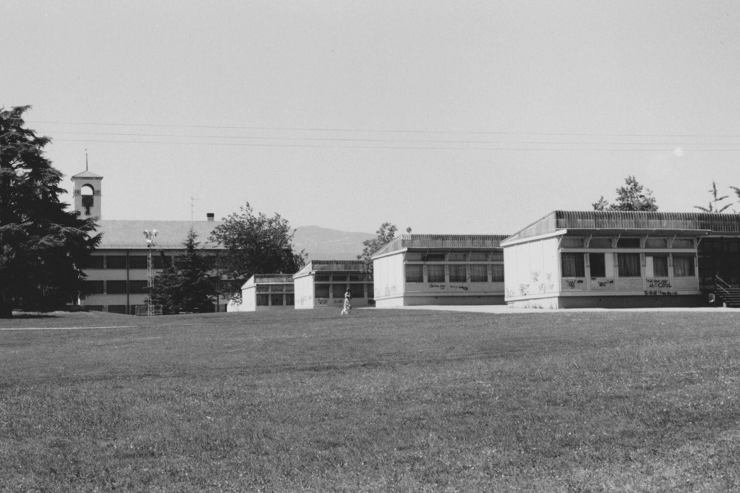
Les pavillons étaient une solution provisoire qui a duré plus de 2 décennies.
Le Centre Commercial de Meyrin
Le centre commercial de Meyrin, haut lieu de rencontre emblématique des Meyrinois. À cette époque, le centre était bien moins fréquenté qu’aujourd’hui, ce qui m’a permis de saisir des moments de tranquillité évoquant une époque où la vie semblait plus simple.
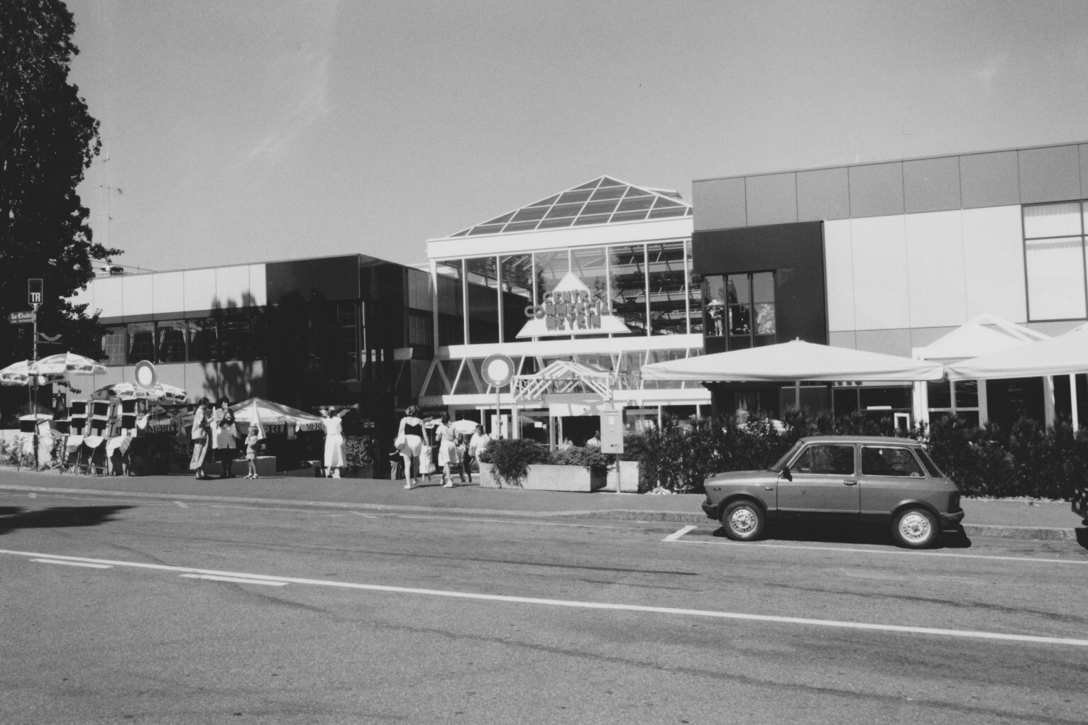
L’entrée principale du centre commercial de Meyrin avec la route directement devant et peu de circulation.
Les Rues de Meyrin : Prulay et Vaudagne
C’est vraiment là où j’ai grandi. En me baladant dans les rues de Prulay et Vaudagne. Les immeubles, les trottoirs et les arbres bordant les rues créent une atmosphère paisible. Ces photos reflètent un temps où la circulation était bien moins dense, offrant une sensation d’espace et de calme.
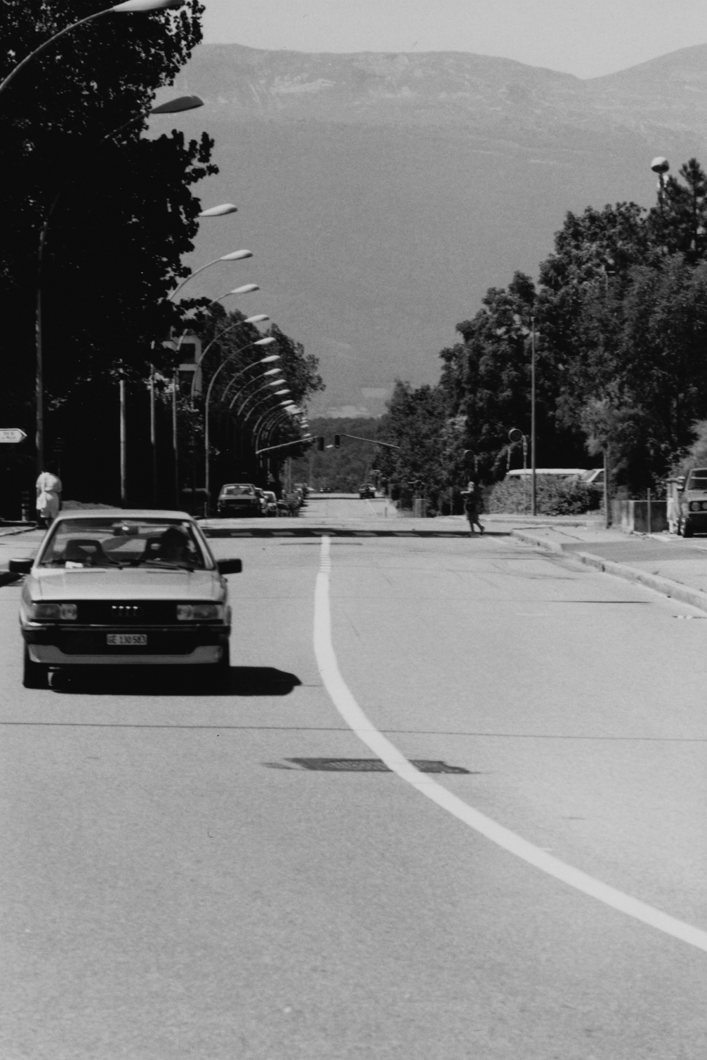
La rue de la Prulay de Meyrin quasiment vide.
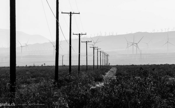
Les Champs-Fréchets
Les champs-Fréchets, avec leurs vastes étendues. Ces paysages agricoles, en contraste avec l’urbanisation environnante, montrent la coexistence harmonieuse entre la nature et la cité.
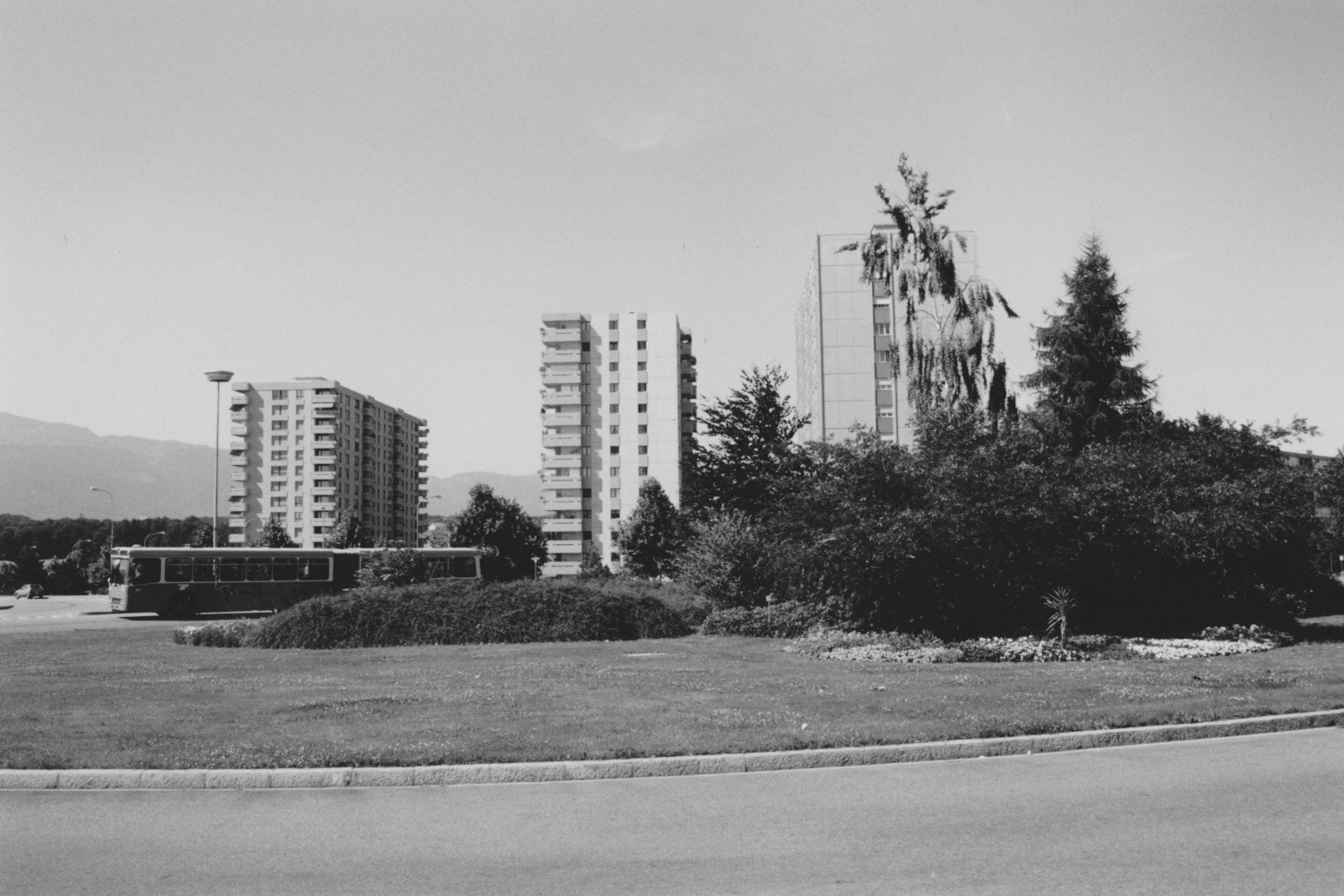
Les grands immeubles des Champs-Fréchets avec le bus 15 sur le rond-point
Le Jardin Robinson : Un Lieu Inoubliable
Le Jardin Robinson, avec son atmosphère unique, est sans doute l’un des lieux les plus mémorables de Meyrin. Ce jardin communautaire, espace de jeux et de détente pour les familles. Les photos en noir et blanc accentuent le charme nostalgique de ce lieu inoubliable.
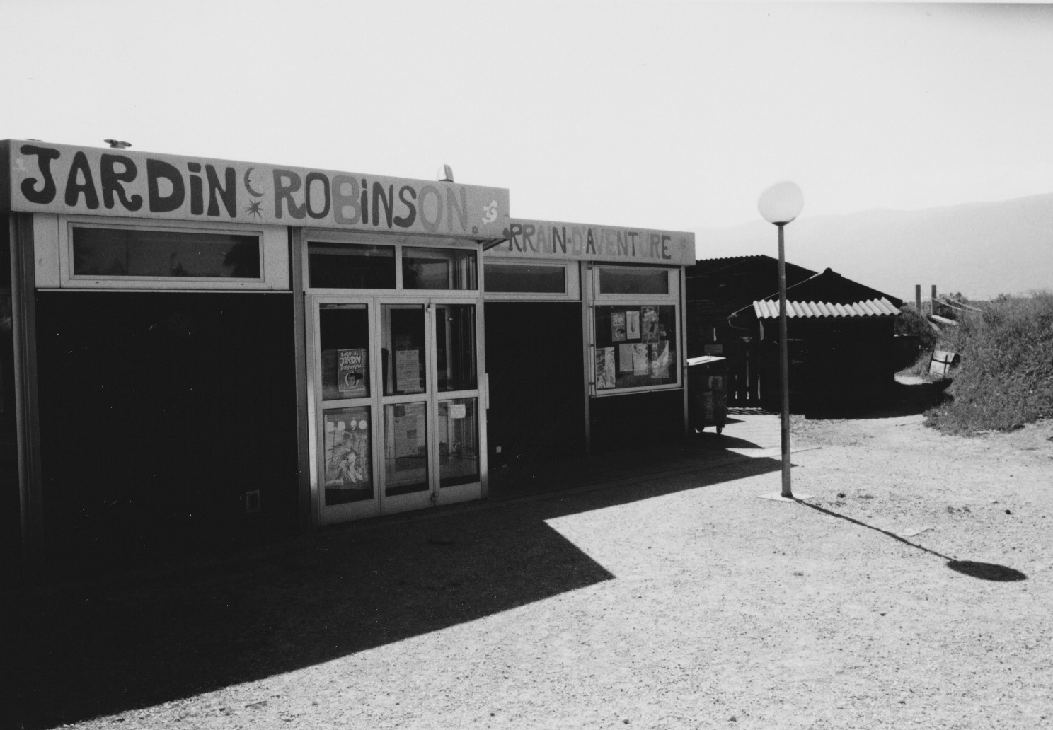
Les bâtiments principaux du jardin robinson avec le début du terrain sur la droite qui était un haut lieu de jeux pour les enfants Meyrinois
Conclusion
Ces 34 photos en noir et blanc de Meyrin, Genève, sont bien plus que de simples clichés ; elles sont un témoignage d’une époque révolue, une invitation à la nostalgie. J’espère que vous apprécierez ce voyage dans le temps autant que j’ai aimé le capturer. N’hésitez pas à partager vos souvenirs de Meyrin dans les commentaires ci-dessous.
La galerie de photos de Meyrin en 1990
Merci de votre visite, et à bientôt pour de nouvelles découvertes photographiques !
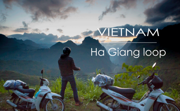
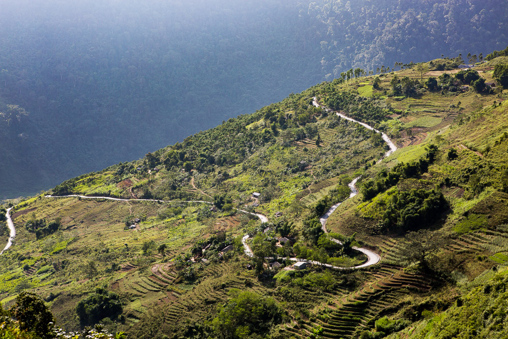
A two-wheeled adventure through the rugged landscapes of northern Vietnam is a journey like no other. Nestled within the majestic mountains of the region lies the Ha Giang Loop, a scenic route renowned for its breathtaking vistas, winding roads, and encounters with vibrant ethnic minority communities. This was our road trip by bicycle through this captivating region, where every twist and turn unveils a new story and leaves an indelible mark on the soul.
The Ha Giang loop
- Itinerary : Ha Giang – Tam Son – Du Già – Meo Vac – Dong Van – Yên Minh – Tam Son – Ha Giang
- Distance : 370 km
- Road conditions : from very good to hard in few short sections.
- Duration : 4 days (3 nights)
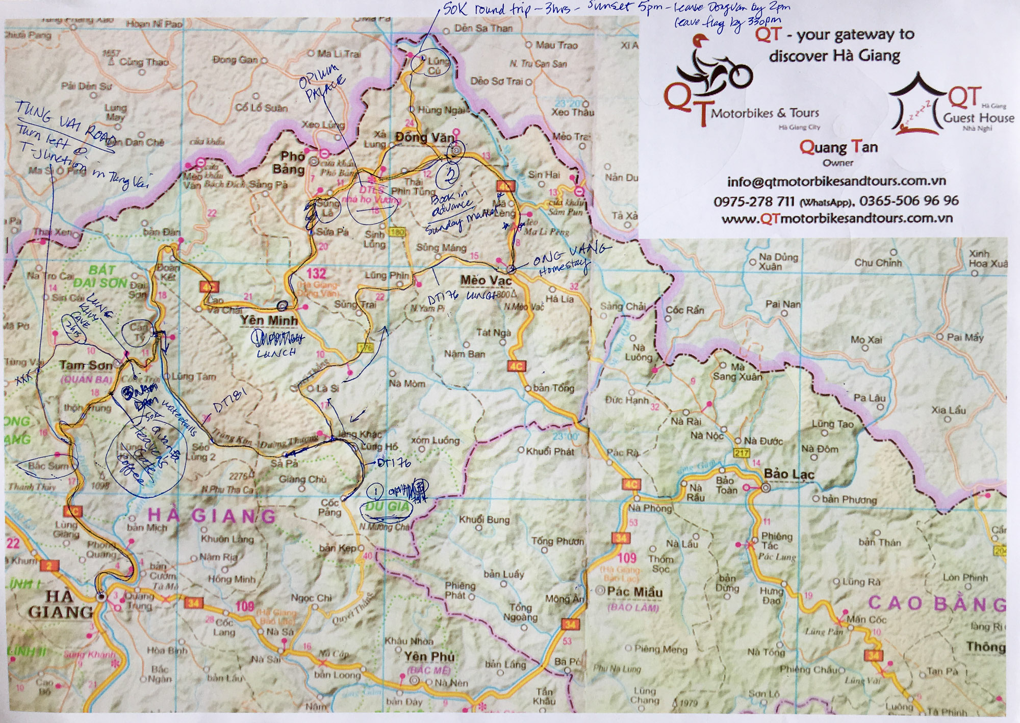
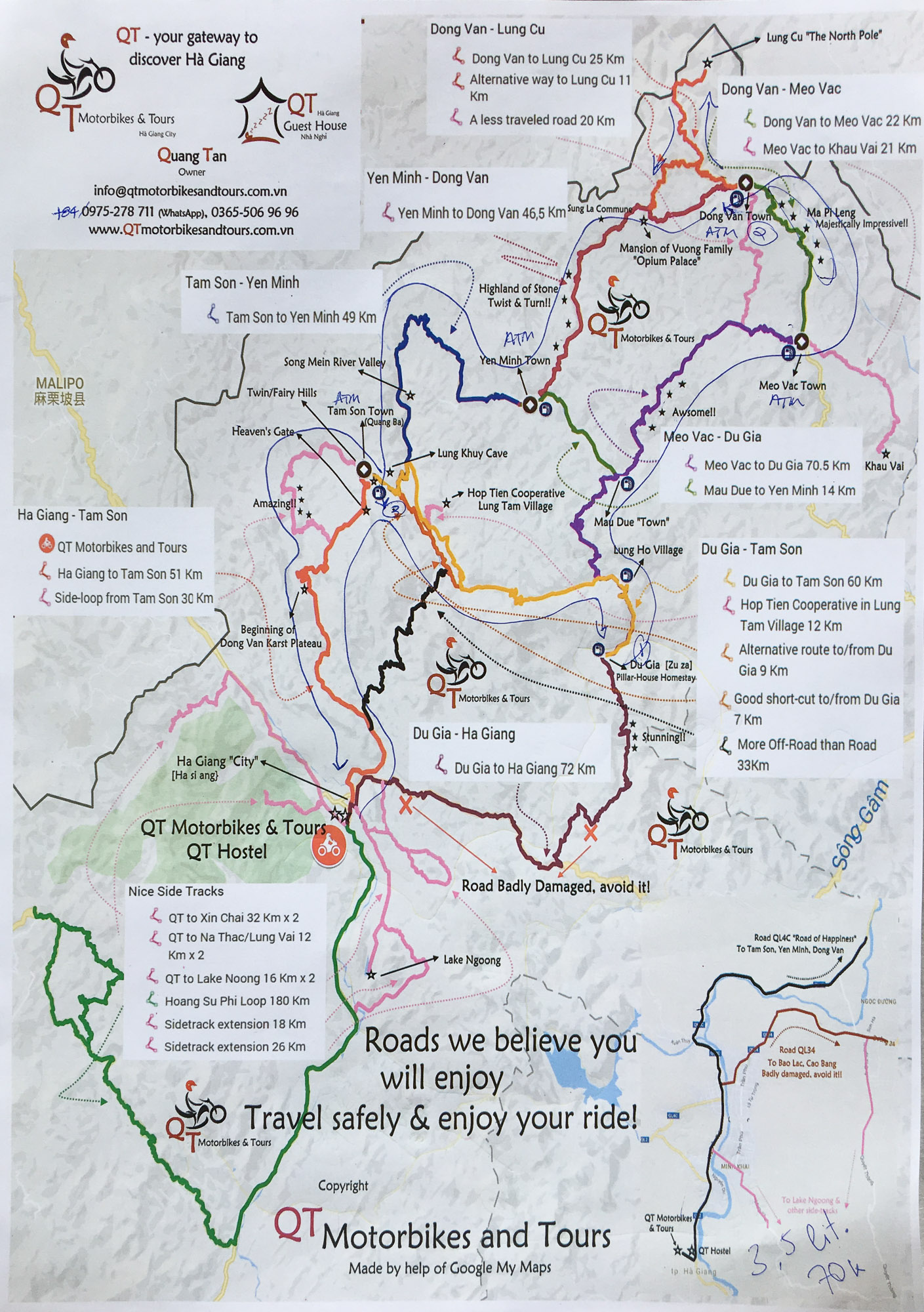
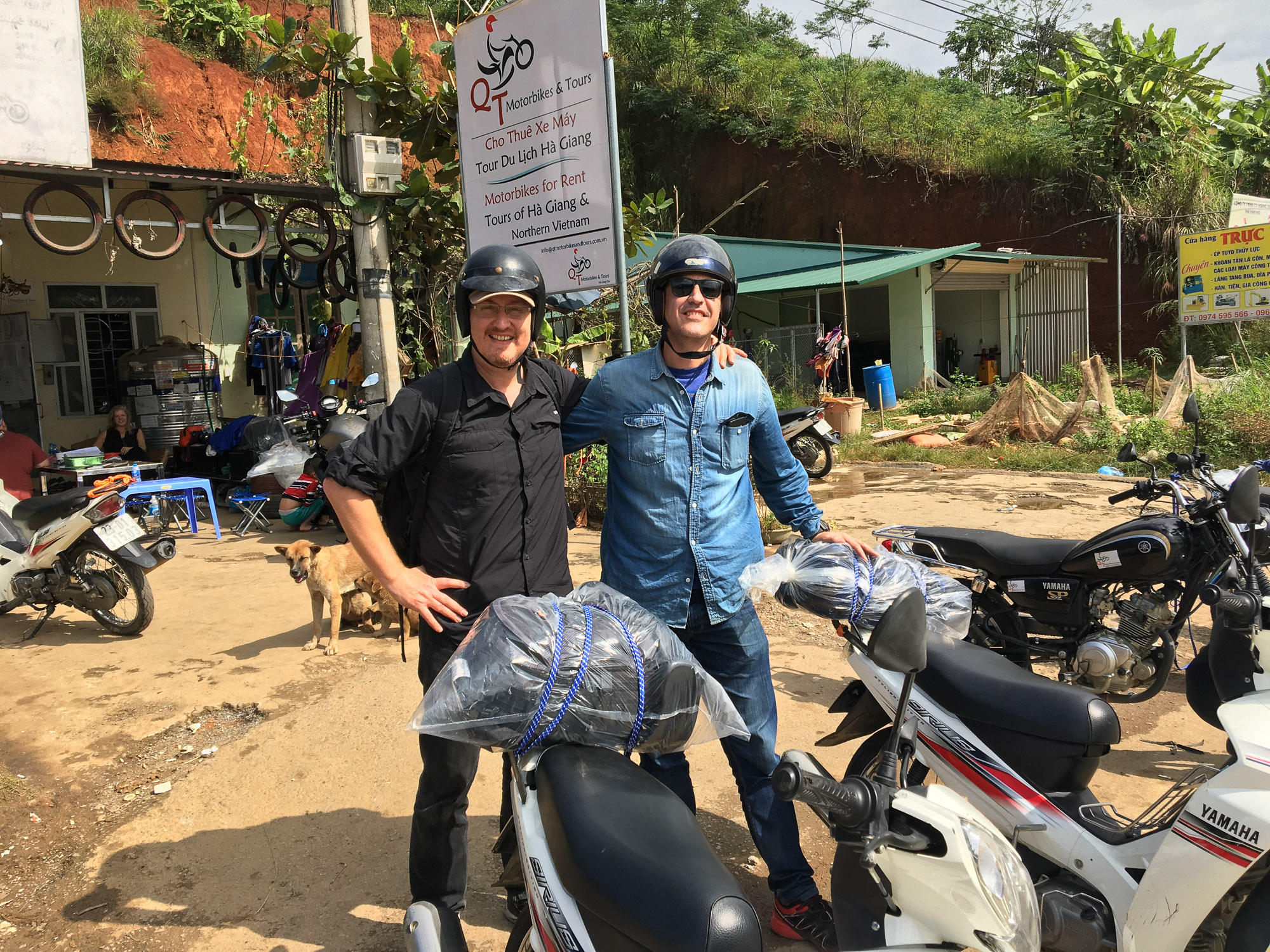
In November 2018 a friend and I did the Ha Giang loop in 4 days. The journey begins in the city of Ha Giang where you can rent motorbikes in several places. I recommend you QT motorbikes rent & tours for several reasons :
- They provide very well maintained motorbikes and scooters.
- They can suggest you loop itineraries according to the time you have and they also provides you a detailed map of your itinerary with all the highlights along the way. Angela from QT arranged us the itinerary above implemented in Google Maps (Below you can have a glance to the map provided by QT).
- They also have a guesthouse in case you need to stay one night in Ha Giang before or after your journey.
- You can leave luggages at and bring with you only necessary stuff for your motorbike tour.
- They are very professional and friendly.
-
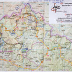
- Map provided by QT motorbikes & tours for our 4 days trip with notes from Angela.
-
- 2nd Map provided by QT motorbikes & tours for our 4 days trip with notes from Angela.
We arrived in Ha Giang very early in the morning (4h30 am) after an awful bus trip from Hanoi. We didn’t sleep a wink and arrived completely exhausted. One of the QT motorbike & tours staff managed us to sleep for at least 2 hours in one of their rooms free of charge so we had a little rest before the long first day of our trip. But unlike us, if you have more time I recommend you to sleep one night in Ha Giang prior to your departure in order prepare for your trip and at the end of your journey to relax!
Day 1 – Hà Giang to Du Già
- Itinerary : Hà Giang – Quan Ba Heaven Gate – Tam Son – Can Ty – Thin Lo – Du Già
- Distance : 109 km
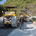
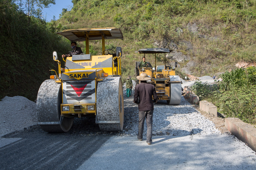
- Road conditions : QL4C road is in fine conditions, however there was some maintenance taking place in some areas. The DT181 road has long portions not yet paved, be cautious with the stony portions of it, to avoid any problems just drive slow and be patient, the good thing about the DT181 is that there is almost no trafic… other than that it’s in good conditions. The last portion of this leg uses the DT176 road which is in good conditions. If you have any update regarding the conditions of this leg don’t hesitate to leave a comment below this article.
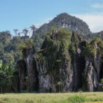
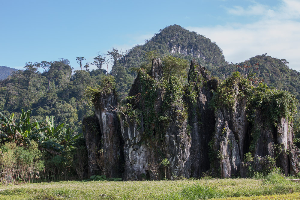
- Highlights : Quan Ba Heaven Gate view point, Nam Dam rural village in Tam Son, the waterfalls along the DT181 and the scenery all the way to Du Già!
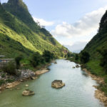
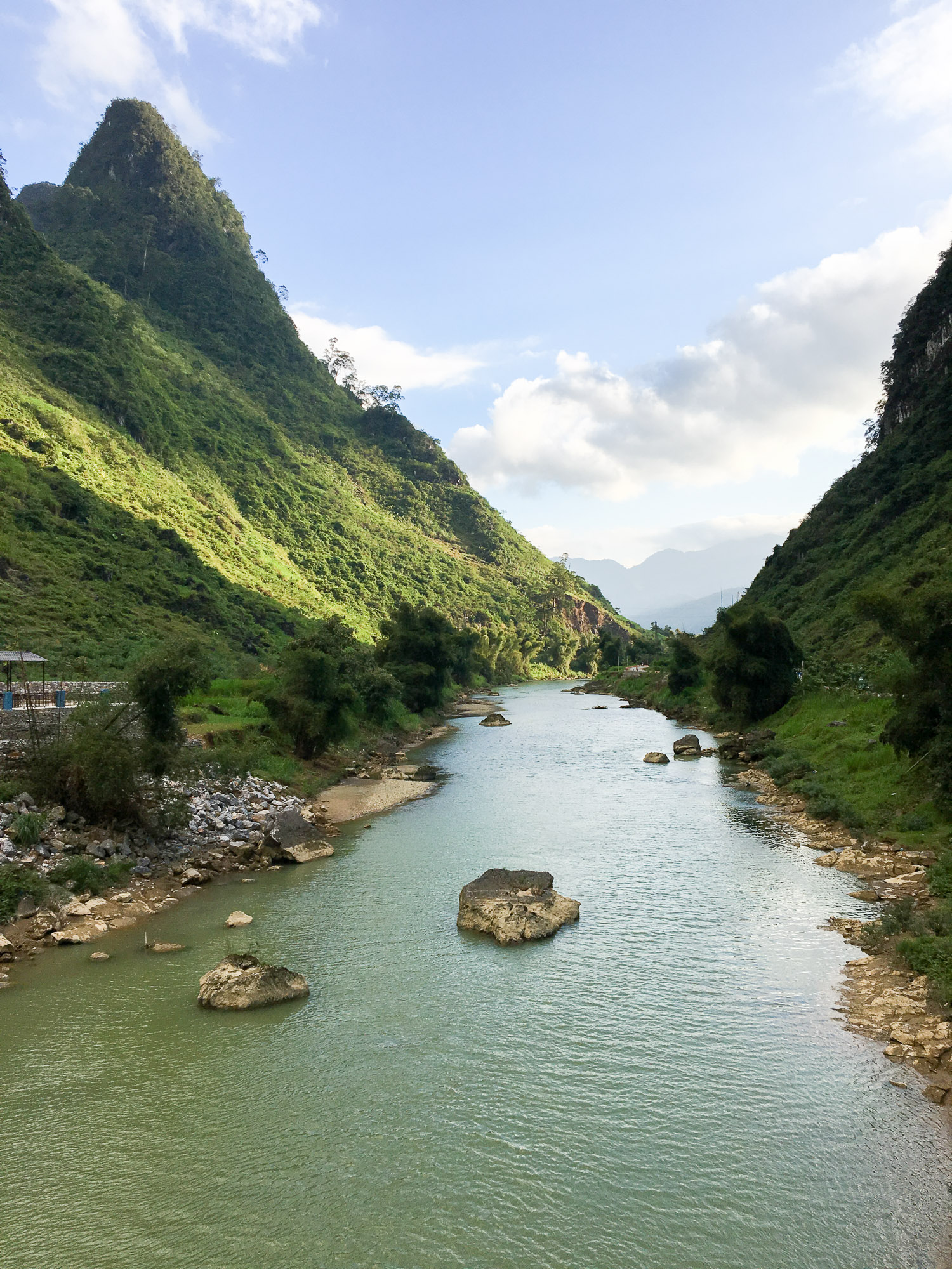
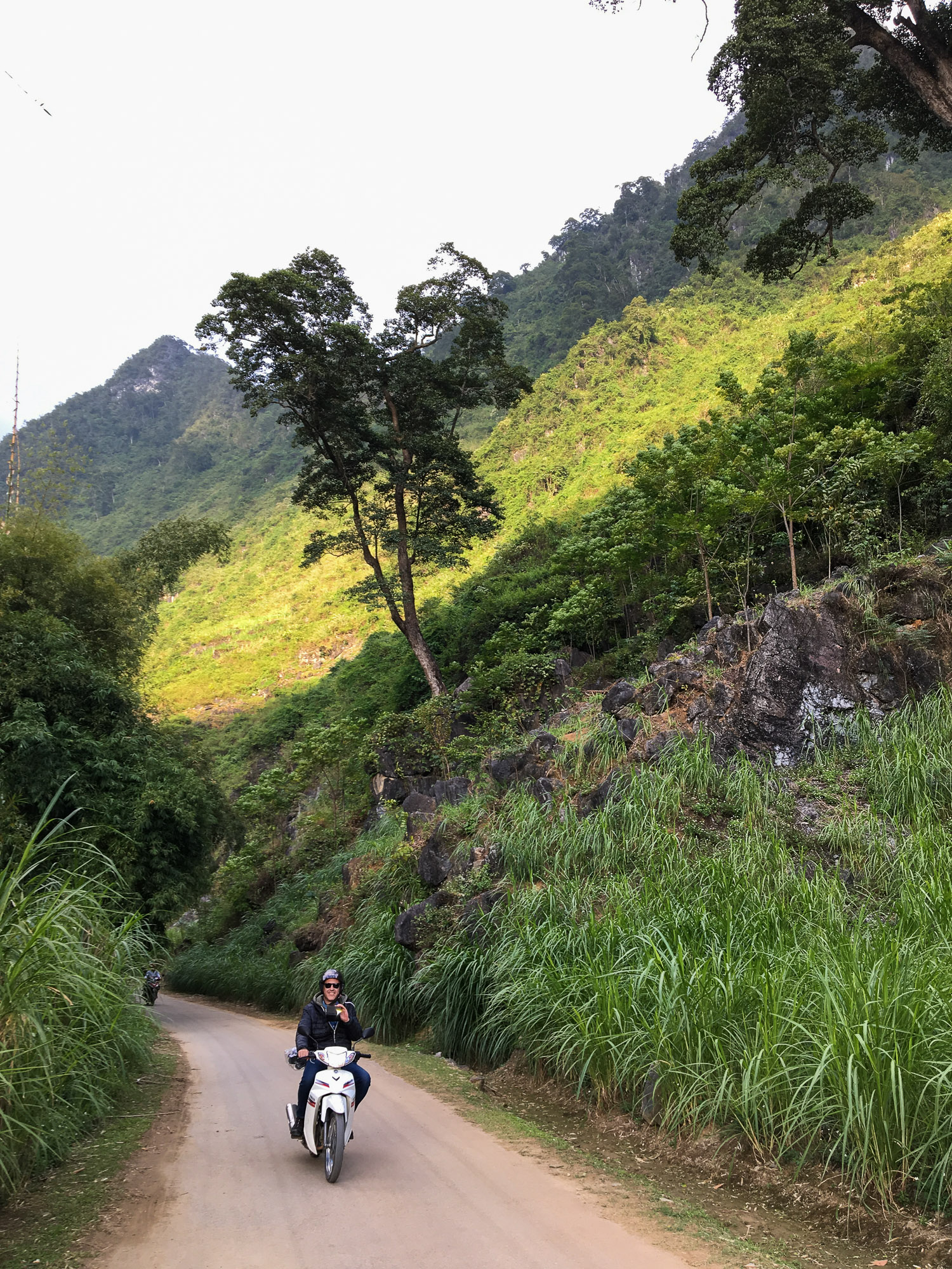
The first leg took us from Ha Giang (our starting point) to the rural village of Du Già. We had to take the QL4C road to Tam Son and continued to Can Ty bridge (crosses the Song Lo river) at km 62 where you leave the QL4C to take the DT181 heading south. I recommend you to leave early (and the other days as well) but 10 am max. for this trip, otherwise you will end up riding in the night upon arrival in Du Già. As soon as we exited Ha Giang city via the QL4C road heading north we dove into the fantastic scenery of the extreme north Vietnam, this marked the start of a non-stop amazing landscapes journey I ever witnessed. Below some pictures of the highlights of the day :
-
- In QT Motorbike rent & tours as we start our journey motorcycling.
-
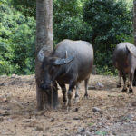
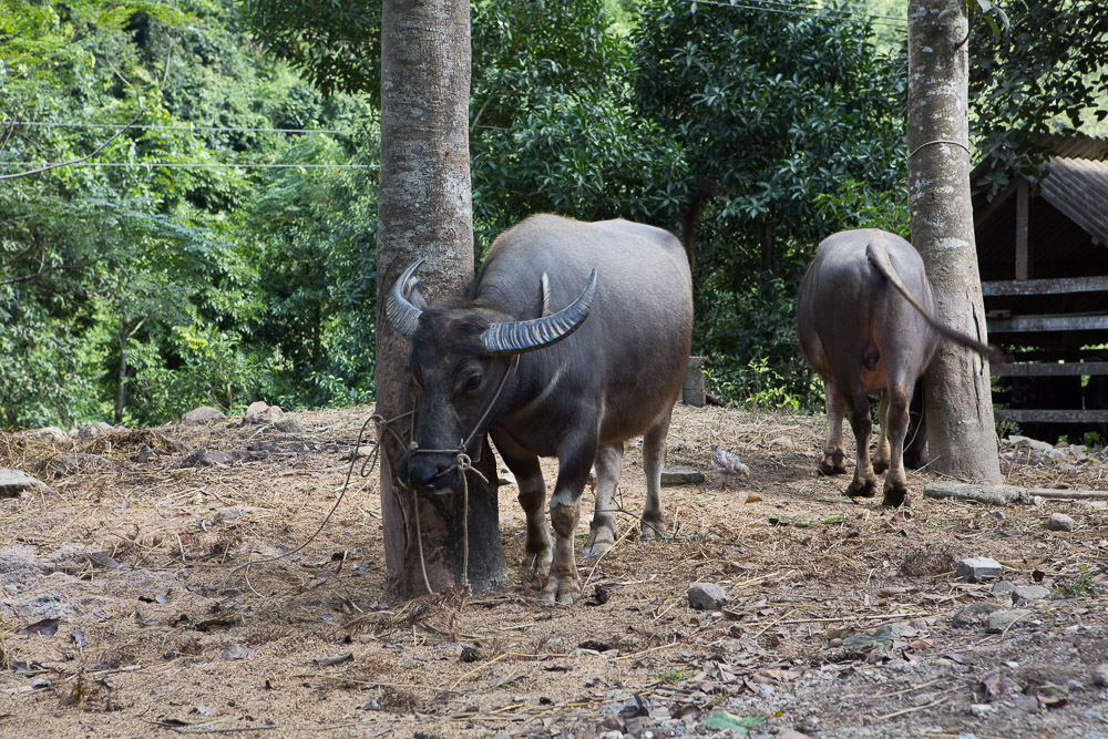
- Water buffalos. One hour after leaving Ha Giang on the QL4C road.
-
- Not far from Cốc Tiểng on the QL4C road.
-
- Some sections of the QL4C road were under maintenance. Just wait a few moments before the workers let you pass.
-
- QL4C road prior to arrive at Quyết Tiến
-
- Quyết Tiến. A lovely place to make a pause.
-
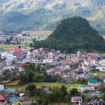
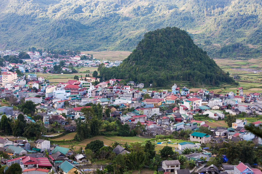
- Arriving in Tam Son.
-
- Sông Lô river just at the cross between the QL4C road and the DT181 road.
-
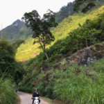
- Just after leaving the QL4C road, the DT181 road was sometimes bumpy.
-
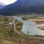
- View of the Sông Lô river from the DT181 road.
We stopped in several places to take pictures, drink a coffee or simply to enjoy the amazing sceneries.
Internet service works very well all along the Ha Giang loop. Make sure to have data roaming available for Google maps (By the way… use map view only and no satellite view if you are running short of data)
Day 1 – Du Già to Dong Van
Itinerary : Du Già – Làng Khác – Mậu Duệ – Lũng Phìn – Sủng Trà – Mèo Vạc – Đồng Văn)
Distance : 92.3 Km
Road conditions : Very good
Dong Van to Tam Son (Day 3)
Itinerary : Dong Van – Lũng Hòa – Sủng Là – Phố Cáo – Yên Minh – Tam Son
Distance : 95.9 Km
Road conditions : Good.
Tam Son to Ha Giang (Day 4)
Itinerary : Tam Son – Tùng Vài – Tân Sơn – Ha Giang
Distance : 64.8 Km
Road conditions : From very good to hard
The shortest leg of this trip but by far the most difficult from a road standpoint.
Personal project
Alejandro Pérez: Photography, video editing, subtitles
Alejandro Pérez: Photography, video editing, subtitles
Startrail photography assembly of 400 photos using StarStax. The video is a screenrecording while Startax was blending the images in lighten mode (with and without comet-like mode). I have separated the image in two:
- The startrail
- The motorway and buildings.
I would have obtained an overexposed result of the motorway if I had used all pictures to blend the motorway and the buildings (as I used it to blend the startrails). That’s why I only used 15-20 significant pictures (I chose the ones with the best car light trails) to compose the lower part of the image. Then using a video editing software (like Premiere Pro) to assemble the two parts of the picture and to reverse the shots.
Gear: Canon ESO 5D Mark III + EF 16-35 f/2.8 + Tripod + automated remote control
Software: Starstax, Lightroom, Photoshop, Premiere Pro.
Software: Starstax, Lightroom, Photoshop, Premiere Pro.
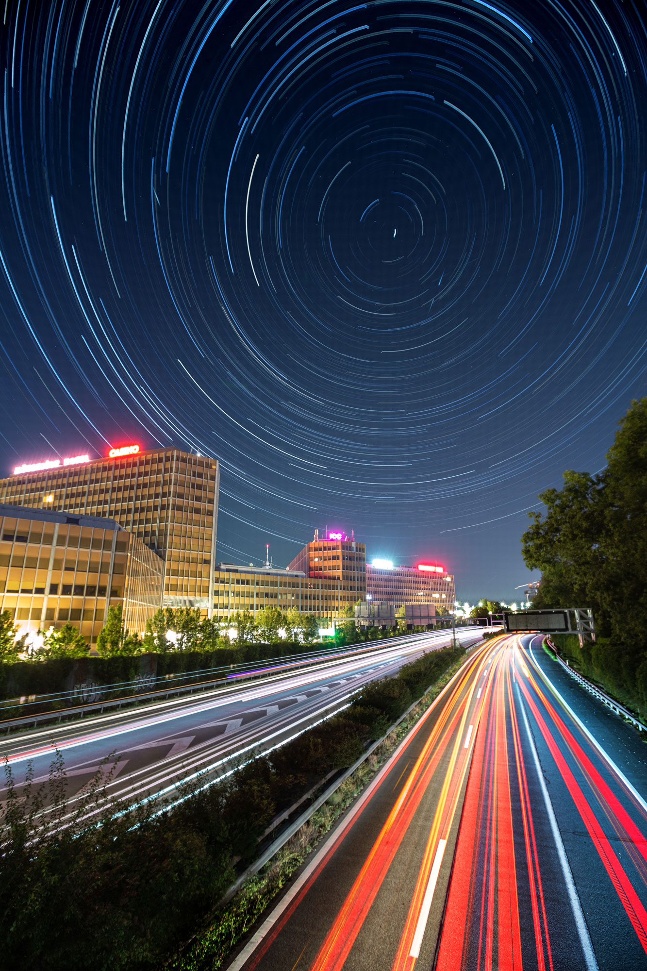
Photography result of the star trails over the motorway – Geneva
Travel Video | Easter Island
Posted by Alejandro Pérez
A long contemplative video with long sequences that will (I hope) bring you the spirit of this mysterious island. I wanted it to be like if you was just there, watching the landscapes and the famous Moai statues. I traveled there in June 2015.
Credits:
Alejandro Pérez: Director, camera, edit & sound mix
Gear used: Canon EOS 5D Mark II, Adobe Permiere Pro, Adobe After Effects, Adobe Audition.
Read More»
This is my humble tribute to one of my favorite film directors. This short movie was inspired by the famous opening of Woody Allen’s movie ‘Manhattan’ (1979). Filmed with a Canon 5D Mark II, still video frames rendered in black & white at 24 frames per second (except the opening south Manhattan shot which was accelerated 3000% faster), added the two black bars to give the cinemascope look and finally added the original soundtrack with woody’s voice.
Short film: “New York in Black and White”
Filmed, edited by Alejandro Pérez
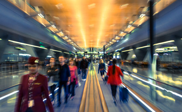
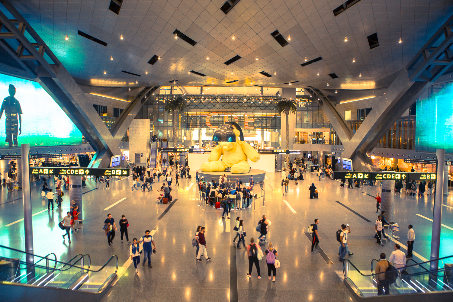
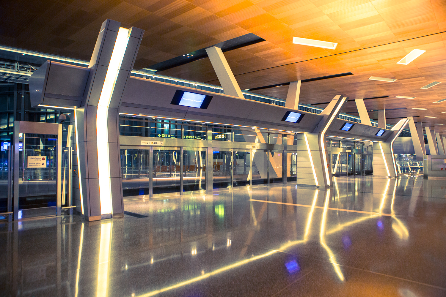
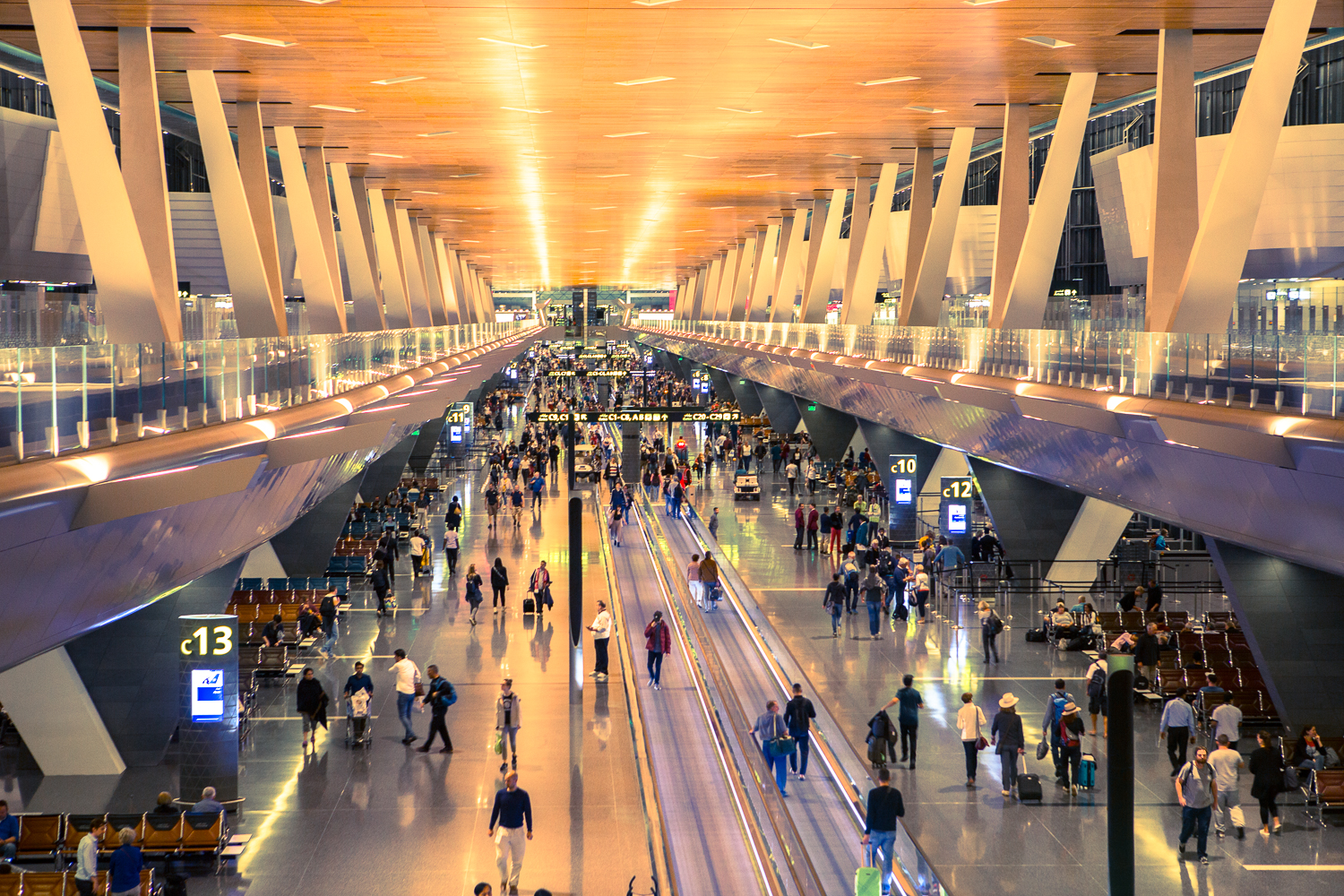
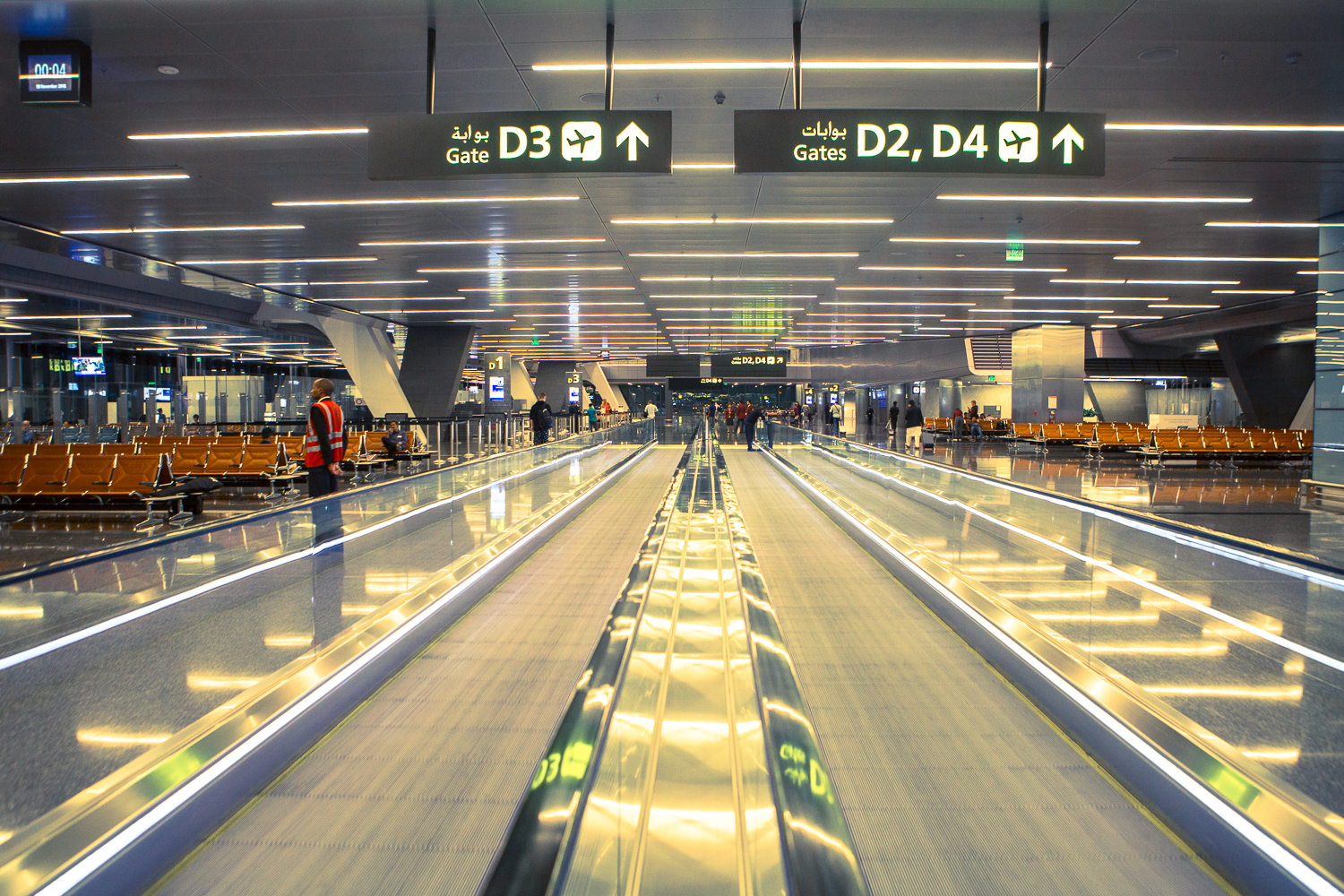
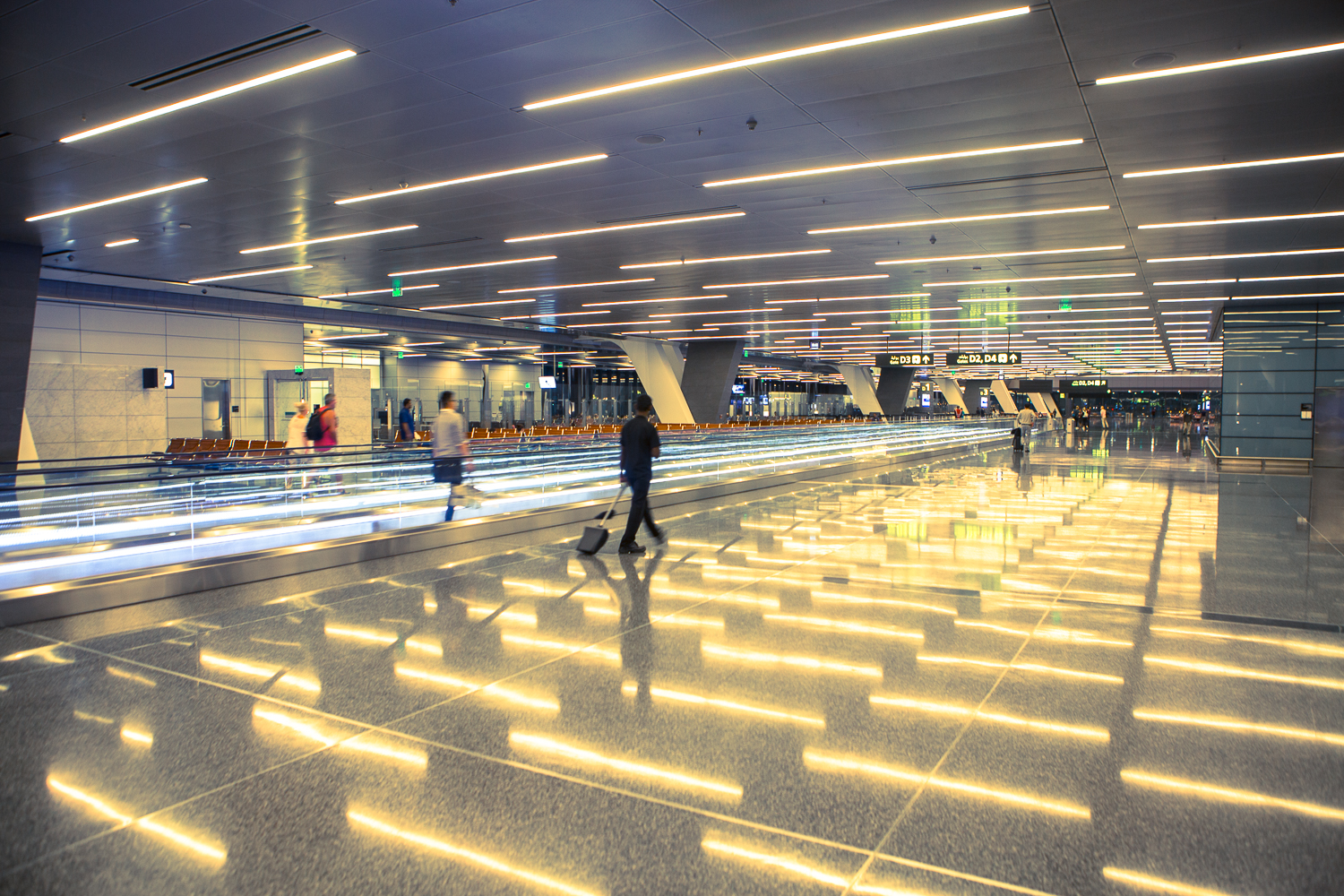
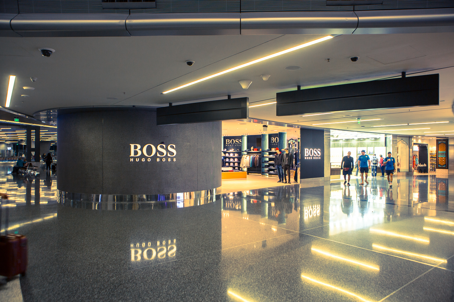
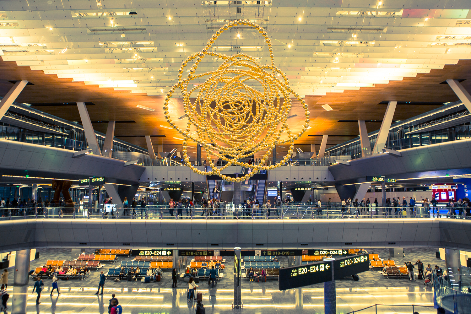
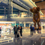
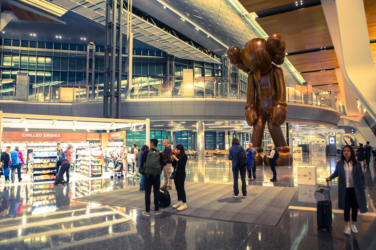
Not the most exciting airport
This picture was taken during my 8 hours layover in Doha after a flight from Bangkok. I was alone and it was boring as hell to say the least.
My post as to be taken in perspective: I just had an awesome trip in northern Vietnam and all the excitements I just had experienced in this wonderful country.
Most post I read on the forums talked about how cool and fancy this airport was and all the hype and how people get exited about shopping all over the place and so on.. but I’m definitely not that type of person. Besides, this airport is quite expensive, for me at least.
My flight arrived at 11:55PM and had to catch my next fight to Geneva at 8:15AM. I walked all through the terminals from pure boredom. I think now I know all the restrooms location in the terminals. The airport is weird and unpersonal, lots of people connecting from almost all over the world and don’t even bother to talk to anyone. Taking pictures was forbidden in some areas for no reason really…
Doha airport is as new and modern as it is boring and I can’t say anything cool about this place.. really. This picture was taken at 6:31am according the camera EXIFs… that’s all about it and I was happy to leave this airport.. completely exhausted and unimpressed.
-

- Doha airport main entrance
-
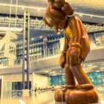
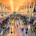
- I was bored in Doha airport like this guy
-
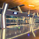
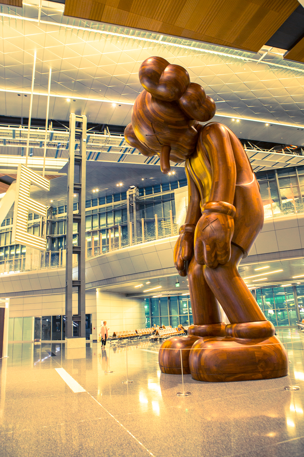
- Doha airport terminal
-
- Doha airport terminal
-

- Doha airport terminal
-

- Doha airport terminal
-

- Doha airport terminal shopping area
-
- Doha airpot terminal
-
- Doha airpot terminal
This is my first blog post of the “Every picture has a story” series. A picture can say a thousand words but sometimes they cannot say what was involved to take them. Here is the first story behind my pictures.
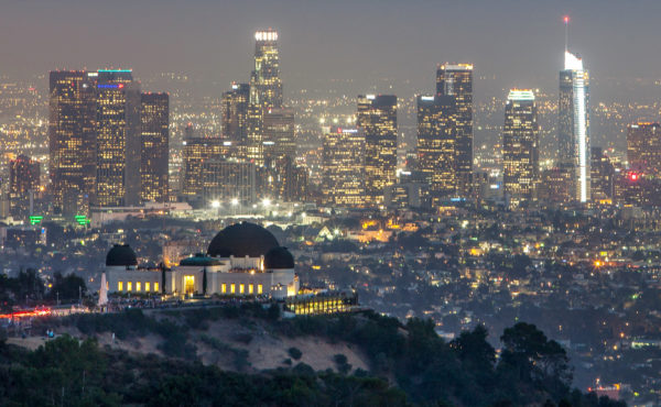
The plan was to take a picture of the Griffith Observatory park with downtown Los Angeles in the background at sunset. Plain and simple and yet I wasn’t too sure how to get to this location where the observatory and downtown are aligned in the frame. So I planned to be there way before sunset in order to have plenty of time ahead to find it.
I started my journey at the Getty museum and asked the Uber driver to pick me up at the museum and drop me by the Hollywood sign and from there I thought i’d walk on some trail to find a good spot… but poor swiss me, I didn’t expect the traffic to be that bad and even with hours ahead I arrived late! I rushed to find this place and finally made it completely soaked in sweat. I didn’t have my tripod (I know I know… stupid me), hence I put my camera on my bag which is something no photographer recommends, too unstable and too close to the ground. I quickly pulled out bushes to get an unobstructed view for the lens, I had my 70-200mm but I would recommend the 400mm. The sun was already low but I managed to get this one which I think is not too bad after all.
So if you want to know where this spot is located: Mt Chapel trail, not far from the antenna of the LA communications facility. If you happen to have others or better suggestions for shooting locations of the Griffith Observatory I would be glad to know them, just leave a message in the comment section below… 🙂
Shooting location on Google Maps :
SWISS | Boeing 777-300ER | Zürich (ZRH) – Los Angeles (LAX) | Flying over Greenland and USA
Posted by Alejandro Pérez
A scenic window seat flight from Zürich (ZRH) – Los Angeles (LAX) onboard the SWISS B777-300 ER (HB-JND). Flying over Iceland, Greenland, Canada, North Dakota, Montana, Wyoming, Utah, Nevada, California. Special thing on this one, it’s the first time I use one of my music demo as the soundtrack for this video. #Swiss #FlySwiss #WindowSeat #Aviation #ScenicFlight
Read More»North Yorkshire Moors Railway
Posted by Alejandro Pérez
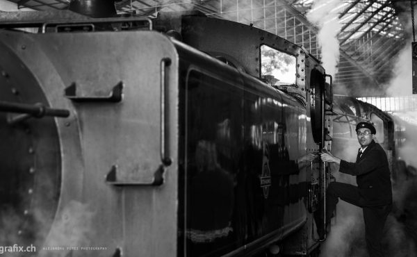
The North Yorkshire Moors Railway (NYMR) is a heritage railway in North Yorkshire, England running through the North York Moors National Park. First opened in 1836 as the Whitby and Pickering Railway, the railway was planned in 1831 by George Stephenson as a means of opening up trade routes inland from the then important seaport of Whitby. The line closed in 1965 and was reopened in 1973 by the North York Moors Historical Railway Trust Ltd. The preserved line is now a significant tourist attraction and has been awarded many industry accolades. (Source : Wikipedia)
Mojave desert
Posted by Alejandro Pérez
One day out of LA to explore the strange beauty of the Mojave desert with my old swiss friend Florian. We drove from Burbank to Mojave passing through the Angeles National Forest, Palmdale and Lancaster.
Getty Center
Posted by Alejandro Pérez
The Getty center… where architecture, photography, painting, sculpture and many other kind of arts meet.
Space Shuttle Endeavour
Posted by Alejandro Pérez
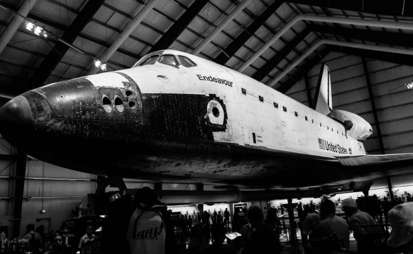
If you are planning to visit the space shuttle Endeavour hall at the California Science Center in Los Angeles and are looking for some tips and advices to photograph the Endeavour hall, this article might be interesting for you.
Read More»Atacama Desert
Posted by Alejandro Pérez
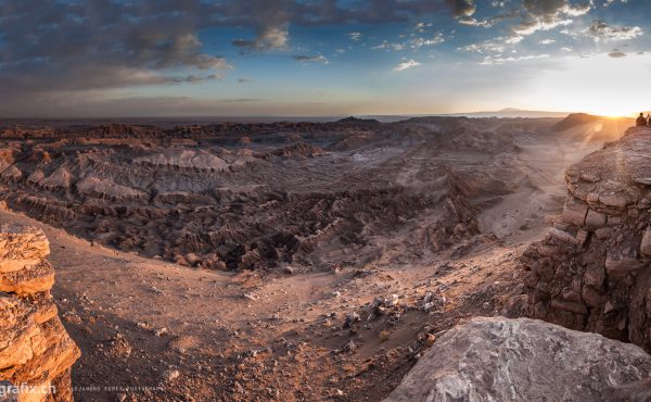
The Atacama desert in Chile is a plateau west of the Andes mountains. It is the driest non-polar desert in the world, the average rainfall is about 15 mm (0.6 in) per year. Most of the desert is composed of stony terrain, salt lakes (salares), sand, and felsic lava that flows towards the Andes.
Read More»Bryce Canyon
Posted by Alejandro Pérez
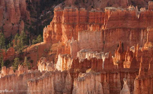
Bryce Canyon National Park is located between Zion Park and Kodachrome Basin. It is one of the most beautiful parks in Utah and is therefore more frequented and less wild. Bryce Canyon is not a canyon, but rather a limestone plateau, located between 2’018 and 2’748 m. Once covered by the sea, it is now covered with fairy chimneys, here called hoodoos. Great hiking and photography is to be done in the park, to admire the rocks, ranging from yellow to dark red as well as chipmunks, a kind of small squirrels.
Death Valley
Posted by Alejandro Pérez
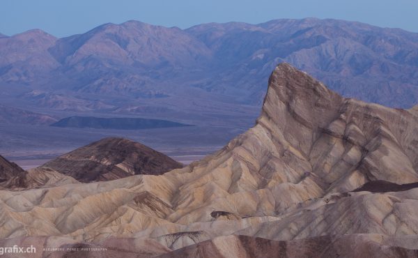
Death Valley National Park offers a variety of landscapes for photographers. There is a large range and diversity of scenes. From valleys to sand dunes to canyons to salt flats to colorful wildflowers, you can come away with many photos from one national park yet people will think you visited many different locations.
Read More»
Zion
Posted by Alejandro Pérez
Road trip on Utah State Route 9. Taking the twists and turns along the very scenic 14 miles (23 km) passing through the Zion National Park.
Grand Canyon
Posted by Alejandro Pérez
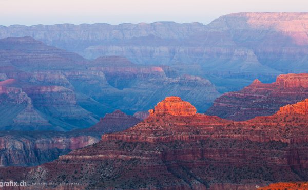
The Colorado Grand Canyon is certainly the most famous and amazing park in the USA. It is in any case the most visited park of the American West (more than 4 million visitors each year).
Colorado, for millions of years, has dug this fabulous canyon.
San Fransisco
Posted by Alejandro Pérez
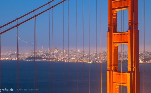
One day if I go to heaven …
I’ll look around and say, ‘It ain’t bad, but it ain’t San Francisco.
– Herb Caen
Monument Valley
Posted by Alejandro Pérez
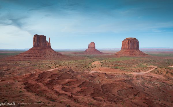
Monument Valley (Utah/Arizona) is a true joy for photographers. The mittens, the landscape, the movie souvenirs.. try to spend at least 2 days in this fabulous park.
This is a short movie filmed during the trip I made with my friend Michele back in February 2015 to northern Chile in the small town of San Pedro de Atacama. The film shows the small town of San Pedro overlooking the Licancabur volcano and located in an arid high plateau. And also a tour we took to the Valle de la Muerte (Death Valley) and Valle de la Luna (Moon Valley).
Personal project
Director, camera, video editing, sound mix, titles: Alejandro Pérez
Software: Adobe Premiere Pro, Adobe After Effects.
Director, camera, video editing, sound mix, titles: Alejandro Pérez
Software: Adobe Premiere Pro, Adobe After Effects.
Man Mo Temple
Posted by Alejandro Pérez
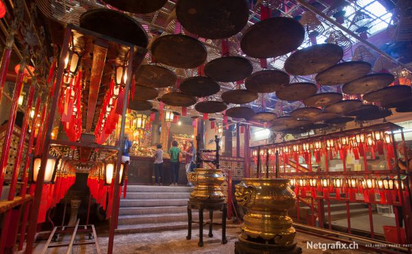
I got to visit for the first time a temple in Asia. This one is located between large buildings and I would certainly recommend to anyone interested in visiting a temple in Hong Kong. It’s full of incense smoke in a quiet and welcoming atmosphere. Photographers are welcome, just do not forget to contribute with 2 Hong Kong Dollars 🙂
Read More»Hong Kong – Black & White
Posted by Alejandro Pérez
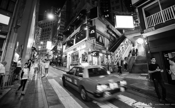
New Hong Kong gallery published! Some pictures (in black and white) of my trip to Hong Kong.
Hong Kong – Colors
Posted by Alejandro Pérez
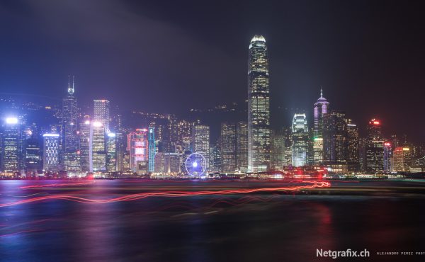
New Hong Kong gallery published! Some pictures (in colors) of my trip to Hong Kong.
Las Vegas
Posted by Alejandro Pérez
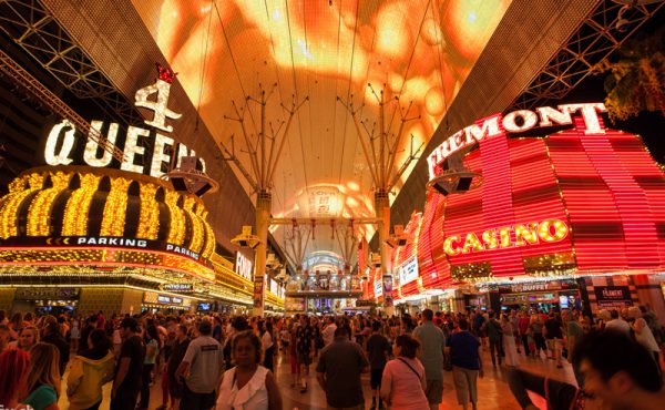
Personal project
Director, camera, video editing, sound mix: Alejandro Pérez
Narration : Kayla
Music : Peter Gabriel (San Jacinto instrumental – New Blood)
Software: Adobe Premiere Pro.
Summer 2015 during our road trip we visited the Bryce Canyon National Park located in the state of Utah in the USA. The park is a delight for hiking and photography. This is a short video of our visit narrated by Kayla, 12 years old, in french (english subtitles available).
Easter Island
Posted by Alejandro Pérez
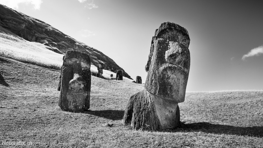
This has to be one of the most amazing place I’ve ever visited. Rapa nui or Easter Island is a Chilean island in the southeastern Pacific Ocean, at the southeasternmost point of the Polynesian Triangle. Easter Island is famous for its 887 extant monumental statues, called Moai, created by the early Rapa Nui people.
Read More»Torres del Paine
Posted by Alejandro Pérez
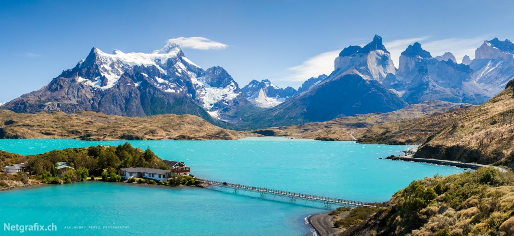 Lago Pehoé
Declared National Park in 1959 and World Biosphere Reserve by UNESCO in 1978, Torres del Paine is undoubtedly one of the most beautiful wilderness of Chile. The diversity of its landscapes – 227’000 ha of steppes, forests, mountains, lakes, waterfalls and glaciers – its rich fauna and flora, made internationally known among hikers and large spaces lovers.
Read More»Perito Moreno
Posted by Alejandro Pérez
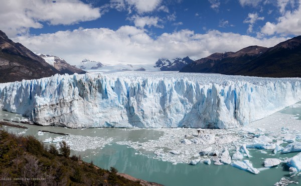
Listed as UNESCO World Heritage, the Perito Moreno Glacier is one of the most spectacular Andean glaciers and easier to access.
Read More»